Weather Alert in Minnesota
Winter Weather Advisory issued February 19 at 2:19AM CST until February 19 at 8:00AM CST by NWS Twin Cities/Chanhassen MN
AREAS AFFECTED: Wright; Hennepin; Ramsey; Washington; McLeod; Carver; Scott; Dakota; St. Croix; Pierce; Dunn
DESCRIPTION: ...CONTINUED LIGHT SNOW TONING AND SNOW COVERED ROADS WILL LEAD TO A SLOW COMMUTE THURSDAY MORNING... .Snow will slowly diminish through the rest of tonight from Morris and Alexandria, east into the Twin Cities and far western Wisconsin. Additional snow accumulations will be up to 1 inch, though the light snow will result in continue snow covered roads in Thursday morning, which will result in a slow commute Thursday morning. * WHAT...Snow. Additional snow accumulations up to one inch. * WHERE...In Minnesota, McLeod, Wright, Carver, Dakota, Hennepin, Ramsey, Scott, and Washington Counties. In Wisconsin, Dunn, Pierce, and St. Croix Counties. * WHEN...Until 8 AM CST this morning. * IMPACTS...Snow covered roads will lead to hazardous conditions impacting the Thursday morning commute.
INSTRUCTION: Slow down and use caution while traveling. In Minnesota, call 5 1 1 or visit 511mn.org for road conditions. In Wisconsin, call 5 1 1 or visit 511wi.gov for road conditions.
Want more detail? Get the Complete 7 Day and Night Detailed Forecast!
Current U.S. National Radar--Current
The Current National Weather Radar is shown below with a UTC Time (subtract 5 hours from UTC to get Eastern Time).

National Weather Forecast--Current
The Current National Weather Forecast and National Weather Map are shown below.

National Weather Forecast for Tomorrow
Tomorrow National Weather Forecast and Tomorrow National Weather Map are show below.

North America Water Vapor (Moisture)
This map shows recent moisture content over North America. Bright and colored areas show high moisture (ie, clouds); brown indicates very little moisture present; black indicates no moisture.

Weather Topic: What are Hole Punch Clouds?
Home - Education - Cloud Types - Hole Punch Clouds
 Next Topic: Mammatus Clouds
A hole punch cloud is an unusual occurrence when a disk-shaped
hole appears in a cirrostratus, cirrocumulus, or altocumulus cloud.
When part of the cloud forms ice crystals, water droplets in the surrounding area
of the cloud evaporate. The effect of this process produces a large elliptical
gap in the cloud. The hole punch cloud formation is rare, but it is not specific
to any geographic area.
Other names which have been used to describe this phenomena include fallstreak hole,
skypunch, and cloud hole.
Next Topic: Mammatus Clouds
Weather Topic: What are Nimbostratus Clouds?
Home - Education - Cloud Types - Nimbostratus Clouds
 Next Topic: Precipitation
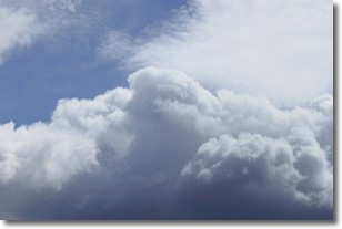
A nimbostratus cloud is similar to a stratus cloud in its formless,
smooth appearance. However, a nimbostratus cloud is darker than a stratus cloud,
because it is thicker.
Unlike a stratus cloud, a nimbostratus cloud typically brings with it the threat
of moderate to heavy precipitation. In some cases, the precipitation may evaporate
before reaching the ground, a phenomenon known as virga.
Next Topic: Precipitation
Current conditions powered by WeatherAPI.com


