Weather Alert in Oklahoma
Flood Warning issued May 26 at 1:28PM CDT until May 27 at 3:00PM CDT by NWS Tulsa OK
AREAS AFFECTED: Cherokee, OK; Mayes, OK; Muskogee, OK; Rogers, OK; Wagoner, OK
DESCRIPTION: * WHAT...Flooding caused by excessive rainfall continues. * WHERE...Portions of east central and northeast Oklahoma, including the following counties, in east central Oklahoma, Cherokee and Muskogee. In northeast Oklahoma, Mayes, Rogers and Wagoner. * WHEN...Until 300 PM CDT Tuesday. * IMPACTS...Flooding of rivers, creeks, streams, and other low-lying and flood-prone locations is imminent or occurring. * ADDITIONAL DETAILS... - At 128 PM CDT, Doppler radar and automated rain gauges measured heavy rains over the past 26 hours of between 2 to 5 inches. Flooding is already occurring in the warned area. Flood waters will be slow to recede and secondary roads may remain flooded through the night into the day Tuesday. - Some locations that will experience flooding include... Muskogee... Claremore... Wagoner... Pryor... Coweta... Pryor Creek... Fort Gibson... Chouteau... Inola... Locust Grove... Salina... Adair... Okay... Hulbert... Porter... Spavinaw... Foyil... Tullahassee... Hoot Owl... Sportsmen Acres Community... - http://www.weather.gov/safety/flood
INSTRUCTION: Turn around, don't drown when encountering flooded roads. Most flood deaths occur in vehicles.
Want more detail? Get the Complete 7 Day and Night Detailed Forecast!
Current U.S. National Radar--Current
The Current National Weather Radar is shown below with a UTC Time (subtract 5 hours from UTC to get Eastern Time).

National Weather Forecast--Current
The Current National Weather Forecast and National Weather Map are shown below.

National Weather Forecast for Tomorrow
Tomorrow National Weather Forecast and Tomorrow National Weather Map are show below.

North America Water Vapor (Moisture)
This map shows recent moisture content over North America. Bright and colored areas show high moisture (ie, clouds); brown indicates very little moisture present; black indicates no moisture.

Weather Topic: What are Hole Punch Clouds?
Home - Education - Cloud Types - Hole Punch Clouds
 Next Topic: Mammatus Clouds
A hole punch cloud is an unusual occurrence when a disk-shaped
hole appears in a cirrostratus, cirrocumulus, or altocumulus cloud.
When part of the cloud forms ice crystals, water droplets in the surrounding area
of the cloud evaporate. The effect of this process produces a large elliptical
gap in the cloud. The hole punch cloud formation is rare, but it is not specific
to any geographic area.
Other names which have been used to describe this phenomena include fallstreak hole,
skypunch, and cloud hole.
Next Topic: Mammatus Clouds
Weather Topic: What are Nimbostratus Clouds?
Home - Education - Cloud Types - Nimbostratus Clouds
 Next Topic: Precipitation
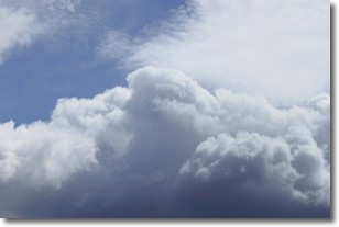
A nimbostratus cloud is similar to a stratus cloud in its formless,
smooth appearance. However, a nimbostratus cloud is darker than a stratus cloud,
because it is thicker.
Unlike a stratus cloud, a nimbostratus cloud typically brings with it the threat
of moderate to heavy precipitation. In some cases, the precipitation may evaporate
before reaching the ground, a phenomenon known as virga.
Next Topic: Precipitation
Current conditions powered by WeatherAPI.com


