Weather Alert in Minnesota
Winter Storm Watch issued February 16 at 2:05AM CST until February 19 at 12:00PM CST by NWS Duluth MN
AREAS AFFECTED: Koochiching; North St. Louis; Northern Cook/Northern Lake; North Itasca; Central St. Louis; North Cass; South Itasca; Northern Aitkin; Carlton/South St. Louis
DESCRIPTION: * WHAT...Heavy mixed precipitation possible. Total snow accumulations between 5 and 10 inches except between 7 and 13 inches for the higher terrain of the North Shore and ice accumulations around one tenth of an inch possible. Winds could gust as high as 40 mph. * WHERE...Northern Aitkin, Koochiching, North Cass, Itasca, Carlton, St. Louis, and Northern Cook and Lake Counties. This includes the Tribal Lands of the Mille Lacs Band, Big Sandy Lake area, the Fond du Lac Band and the Bois Forte Band, Nett Lake, Lake Vermilion and, Deer Creek areas. Other locations including Voyageurs National Park. The entire Boundary Waters is also included. * WHEN...From Tuesday evening through Thursday morning. * IMPACTS...Travel could be very difficult. The hazardous conditions could impact the Tuesday evening, Wednesday, and Thursday morning commutes.
INSTRUCTION: Monitor the latest forecasts for updates on this situation.
Want more detail? Get the Complete 7 Day and Night Detailed Forecast!
Current U.S. National Radar--Current
The Current National Weather Radar is shown below with a UTC Time (subtract 5 hours from UTC to get Eastern Time).

National Weather Forecast--Current
The Current National Weather Forecast and National Weather Map are shown below.

National Weather Forecast for Tomorrow
Tomorrow National Weather Forecast and Tomorrow National Weather Map are show below.

North America Water Vapor (Moisture)
This map shows recent moisture content over North America. Bright and colored areas show high moisture (ie, clouds); brown indicates very little moisture present; black indicates no moisture.

Weather Topic: What is Evaporation?
Home - Education - Precipitation - Evaporation
 Next Topic: Fog
Evaporation is the process which returns water from the earth
back to the atmosphere, and is another crucial process in the water cycle.
Evaporation is the transformation of liquid into gas, and it happens because
molecules are excited by the application of energy and turn into vapor.
In order for water to evaporate it has to be on the surface of a body of water.
Next Topic: Fog
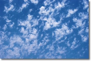
Weather Topic: What are Fractus Clouds?
Home - Education - Cloud Types - Fractus Clouds
 Next Topic: Freezing Rain
A fractus cloud (scud) is a fragmented, tattered cloud which has
likely been sheared off of another cloud. They are accessory clouds, meaning they
develop from parent clouds, and are named in a way which describes the original
cloud which contained them.
Fractus clouds which have originated from cumulus clouds are referred to as
cumulus fractus, while fractus clouds which have originated from stratus clouds
are referred to as stratus fractus. Under certain conditions a fractus cloud might
merge with another cloud, or develop into a cumulus cloud, but usually a
fractus cloud seen by itself will dissipate rapidly.
They are often observed on the leading and trailing edges of storm clouds,
and are a display of wind activity.
Next Topic: Freezing Rain
Current conditions powered by WeatherAPI.com


