Weather Alert in Minnesota
Severe Thunderstorm Warning issued September 4 at 5:24PM CDT until September 4 at 6:00PM CDT by NWS Sioux Falls SD
AREAS AFFECTED: Cottonwood, MN; Lyon, MN; Murray, MN
DESCRIPTION: SVRFSD The National Weather Service in Sioux Falls has issued a * Severe Thunderstorm Warning for... Southern Lyon County in southwestern Minnesota... Western Cottonwood County in southwestern Minnesota... Northern Murray County in southwestern Minnesota... * Until 600 PM CDT. * At 524 PM CDT, a severe thunderstorm was located over Balaton, or 15 miles north of Slayton, moving southeast at 70 mph. HAZARD...60 mph wind gusts. SOURCE...Radar indicated. IMPACT...Expect damage to roofs, siding, and trees. * This severe thunderstorm will be near... Tracy, Currie, and Lake Shetek State Park around 530 PM CDT. Dovray around 535 PM CDT. Westbrook around 540 PM CDT. Other locations in the path of this severe thunderstorm include Storden.
INSTRUCTION: For your protection move to an interior room on the lowest floor of a building. To report severe weather, contact your nearest law enforcement agency. They will send your report to the National Weather Service office in Sioux Falls.
Want more detail? Get the Complete 7 Day and Night Detailed Forecast!
Current U.S. National Radar--Current
The Current National Weather Radar is shown below with a UTC Time (subtract 5 hours from UTC to get Eastern Time).

National Weather Forecast--Current
The Current National Weather Forecast and National Weather Map are shown below.

National Weather Forecast for Tomorrow
Tomorrow National Weather Forecast and Tomorrow National Weather Map are show below.

North America Water Vapor (Moisture)
This map shows recent moisture content over North America. Bright and colored areas show high moisture (ie, clouds); brown indicates very little moisture present; black indicates no moisture.

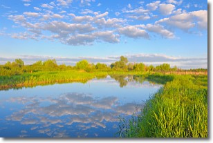
Weather Topic: What are Stratocumulus Clouds?
Home - Education - Cloud Types - Stratocumulus Clouds
 Next Topic: Stratus Clouds
Stratocumulus clouds are similar to altocumulus clouds in their
fluffy appearance, but have a slightly darker shade due to their additional mass.
A good way to distinguish the two cloud types is to hold your hand out and measure
the size of an individual cloud; if it is the size of your thumb it is generally
an altocumulus cloud, if it is the size of your hand it is generally a
stratocumulus cloud.
It is uncommon for stratocumulus clouds to produce precipitation, but if they do
it is usually a light rain or snow.
Next Topic: Stratus Clouds
Weather Topic: What are Wall Clouds?
Home - Education - Cloud Types - Wall Clouds
 Next Topic: Altocumulus Clouds
A wall cloud forms underneath the base of a cumulonimbus cloud,
and can be a hotbed for deadly tornadoes.
Wall clouds are formed by air flowing into the cumulonimbus clouds, which can
result in the wall cloud descending from the base of the cumulonimbus cloud, or
rising fractus clouds which join to the base of the storm cloud as the wall cloud
takes shape.
Wall clouds can be very large, and in the Northern Hemisphere they generally
form at the southern edge of cumulonimbus clouds.
Next Topic: Altocumulus Clouds
Current conditions powered by WeatherAPI.com


