Weather Alert in Florida
Flood Warning issued September 5 at 8:44AM EDT by NWS Melbourne FL
AREAS AFFECTED: Lake, FL; Volusia, FL
DESCRIPTION: ...The Flood Warning continues for the following rivers in Florida... St Johns River Near Astor affecting Lake and Volusia Counties. .On the Saint Johns River Near Astor, northeasterly winds and recent rainfall over the basin have maintained levels in Minor Flood Stage. The river is forecast to continue on a very slow decline into next week. However, additional rainfall or lingering northeast winds could slow the rate of decline. For the St. Johns River...including Astor...Minor flooding is forecast. Additional information is available at www.weather.gov. The next statement will be issued Saturday afternoon at noon EDT. * WHAT...Minor flooding is occurring and minor flooding is forecast. * WHERE...St Johns River near Astor. * WHEN...Until further notice. * IMPACTS...At 2.8 feet, Docks and boat ramps covered at South Moon Fish Camp and approaching sea wall at Blair's Jungle Den. Water approaching sites closest to the river at Fish Tales RV Resort and Astor Landing Campground. Portion of Clair Street covered by river water south of the Butler Boat Ramp. Docks underwater at the Astor Bridge Marina and along Riveredge Drive. Portions of Fox Road are covered with water nearest to the river. Acorn, Hazelnut and Redbud roads are underwater with yards inundated. * ADDITIONAL DETAILS... - At 7:30 AM EDT Friday the stage was 2.6 feet. - Bankfull stage is 2.0 feet. - Recent Activity...The maximum river stage in the 24 hours ending at 7:30 AM EDT Friday was 2.7 feet. - Forecast...The river is expected to remain steady above flood stage at 2.6 feet. - Flood stage is 2.3 feet. - http://www.weather.gov/safety/flood
INSTRUCTION: N/A
Want more detail? Get the Complete 7 Day and Night Detailed Forecast!
Current U.S. National Radar--Current
The Current National Weather Radar is shown below with a UTC Time (subtract 5 hours from UTC to get Eastern Time).

National Weather Forecast--Current
The Current National Weather Forecast and National Weather Map are shown below.

National Weather Forecast for Tomorrow
Tomorrow National Weather Forecast and Tomorrow National Weather Map are show below.

North America Water Vapor (Moisture)
This map shows recent moisture content over North America. Bright and colored areas show high moisture (ie, clouds); brown indicates very little moisture present; black indicates no moisture.

Weather Topic: What are Hole Punch Clouds?
Home - Education - Cloud Types - Hole Punch Clouds
 Next Topic: Mammatus Clouds
A hole punch cloud is an unusual occurrence when a disk-shaped
hole appears in a cirrostratus, cirrocumulus, or altocumulus cloud.
When part of the cloud forms ice crystals, water droplets in the surrounding area
of the cloud evaporate. The effect of this process produces a large elliptical
gap in the cloud. The hole punch cloud formation is rare, but it is not specific
to any geographic area.
Other names which have been used to describe this phenomena include fallstreak hole,
skypunch, and cloud hole.
Next Topic: Mammatus Clouds
Weather Topic: What are Nimbostratus Clouds?
Home - Education - Cloud Types - Nimbostratus Clouds
 Next Topic: Precipitation
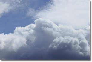
A nimbostratus cloud is similar to a stratus cloud in its formless,
smooth appearance. However, a nimbostratus cloud is darker than a stratus cloud,
because it is thicker.
Unlike a stratus cloud, a nimbostratus cloud typically brings with it the threat
of moderate to heavy precipitation. In some cases, the precipitation may evaporate
before reaching the ground, a phenomenon known as virga.
Next Topic: Precipitation
Current conditions powered by WeatherAPI.com


