Weather Alert in California
Red Flag Warning issued July 25 at 3:58AM PDT until July 25 at 11:00PM PDT by NWS Medford OR
AREAS AFFECTED: Western Klamath National Forest; Central Siskiyou County Including Shasta Valley; Shasta-Trinity National Forest in Siskiyou County; Siskiyou County from the Cascade Mountains East and South to Mt Shasta; Modoc County Except for the Surprise Valley; Klamath Basin and the Fremont-Winema National Forest; South Central Oregon Desert including the BLM Land in Eastern Lake and Western Harney Counties
DESCRIPTION: * AFFECTED AREA...The south eastern portion of Fire Weather Zone(FWZ) 280 and southern portions of FWZs 624 and 625. In addition, FWZs 281, 282, 284 and 285. * THUNDERSTORMS...Scattered to widespread thunderstorm activity with abundant lightning. Thunderstorms will be accompanied by rain at times. But, the amount of lightning is expected to exceed critical thresholds. * OUTFLOW WINDS...Gusts around 40 to 60 mph are possible with any thunderstorms that develop. * DETAILED URL...View the hazard area in detail at https://www.wrh.noaa.gov/map/?wfo=mfr
INSTRUCTION: Follow all fire restrictions. You can find your county's emergency sign up form as well as links to fire restrictions at weather.gov/medford/wildfire. One less spark, one less wildfire. Be sure you're signed up for your county's emergency alert system. Familiarize yourself with your emergency plan and make sure you listen to emergency services. Visit ready.gov/plan for more information.
Want more detail? Get the Complete 7 Day and Night Detailed Forecast!
Current U.S. National Radar--Current
The Current National Weather Radar is shown below with a UTC Time (subtract 5 hours from UTC to get Eastern Time).

National Weather Forecast--Current
The Current National Weather Forecast and National Weather Map are shown below.

National Weather Forecast for Tomorrow
Tomorrow National Weather Forecast and Tomorrow National Weather Map are show below.

North America Water Vapor (Moisture)
This map shows recent moisture content over North America. Bright and colored areas show high moisture (ie, clouds); brown indicates very little moisture present; black indicates no moisture.

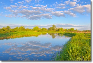
Weather Topic: What are Stratocumulus Clouds?
Home - Education - Cloud Types - Stratocumulus Clouds
 Next Topic: Stratus Clouds
Stratocumulus clouds are similar to altocumulus clouds in their
fluffy appearance, but have a slightly darker shade due to their additional mass.
A good way to distinguish the two cloud types is to hold your hand out and measure
the size of an individual cloud; if it is the size of your thumb it is generally
an altocumulus cloud, if it is the size of your hand it is generally a
stratocumulus cloud.
It is uncommon for stratocumulus clouds to produce precipitation, but if they do
it is usually a light rain or snow.
Next Topic: Stratus Clouds
Weather Topic: What are Wall Clouds?
Home - Education - Cloud Types - Wall Clouds
 Next Topic: Altocumulus Clouds
A wall cloud forms underneath the base of a cumulonimbus cloud,
and can be a hotbed for deadly tornadoes.
Wall clouds are formed by air flowing into the cumulonimbus clouds, which can
result in the wall cloud descending from the base of the cumulonimbus cloud, or
rising fractus clouds which join to the base of the storm cloud as the wall cloud
takes shape.
Wall clouds can be very large, and in the Northern Hemisphere they generally
form at the southern edge of cumulonimbus clouds.
Next Topic: Altocumulus Clouds
Current conditions powered by WeatherAPI.com


