Weather Alert in Alaska
Winter Storm Warning issued March 3 at 2:52PM AKST until March 4 at 12:00PM AKST by NWS Juneau AK
AREAS AFFECTED: Glacier Bay; Eastern Chichagof Island; Cape Fairweather to Lisianski Strait; City and Borough of Juneau
DESCRIPTION: ...SNOW FOR THE NORTHERN AND CENTRAL PANHANDLE THROUGH WEDNESDAY... The next surge of snow is expected this evening as the main low moves closer to the panhandle bringing more moisture to the area. This next surge of moisture is expected to bring increasing snowfall rates to the Icy Strait corridor this evening. Along with this second wave of snow, the original band of snow is expected to set up around the Yakutat area bringing more accumulating snow to the area with the heaviest parts to the west of Yakutat. * WHAT...Heavy snow. Additional snow accumulations of 4 to 10 inches. * WHERE...Glacier Bay, Eastern Chichagof Island, Cape Fairweather to Lisianski Strait and City and Borough of Juneau. * WHEN...Until noon AKST Wednesday. * IMPACTS...Travel will be very difficult. The hazardous conditions could impact the morning or evening commute. * ADDITIONAL DETAILS...Heaviest snowfall rates are expected this afternoon into Wednesday morning, with snowfall rates of an inch an hour possible. Gusty winds around downtown Juneau and Douglas could cause some areas of blowing snow.
INSTRUCTION: If you must travel, keep an extra flashlight, food, and water with you in case of an emergency. People are urged to prepare their property before the onset of winter weather. For the latest road conditions, where available, call 5 1 1 or visit 511.alaska.gov.
Want more detail? Get the Complete 7 Day and Night Detailed Forecast!
Current U.S. National Radar--Current
The Current National Weather Radar is shown below with a UTC Time (subtract 5 hours from UTC to get Eastern Time).

National Weather Forecast--Current
The Current National Weather Forecast and National Weather Map are shown below.

National Weather Forecast for Tomorrow
Tomorrow National Weather Forecast and Tomorrow National Weather Map are show below.

North America Water Vapor (Moisture)
This map shows recent moisture content over North America. Bright and colored areas show high moisture (ie, clouds); brown indicates very little moisture present; black indicates no moisture.

Weather Topic: What are Hole Punch Clouds?
Home - Education - Cloud Types - Hole Punch Clouds
 Next Topic: Mammatus Clouds
A hole punch cloud is an unusual occurrence when a disk-shaped
hole appears in a cirrostratus, cirrocumulus, or altocumulus cloud.
When part of the cloud forms ice crystals, water droplets in the surrounding area
of the cloud evaporate. The effect of this process produces a large elliptical
gap in the cloud. The hole punch cloud formation is rare, but it is not specific
to any geographic area.
Other names which have been used to describe this phenomena include fallstreak hole,
skypunch, and cloud hole.
Next Topic: Mammatus Clouds
Weather Topic: What are Nimbostratus Clouds?
Home - Education - Cloud Types - Nimbostratus Clouds
 Next Topic: Precipitation
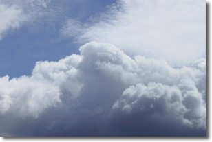
A nimbostratus cloud is similar to a stratus cloud in its formless,
smooth appearance. However, a nimbostratus cloud is darker than a stratus cloud,
because it is thicker.
Unlike a stratus cloud, a nimbostratus cloud typically brings with it the threat
of moderate to heavy precipitation. In some cases, the precipitation may evaporate
before reaching the ground, a phenomenon known as virga.
Next Topic: Precipitation
Current conditions powered by WeatherAPI.com


