Weather Alert in California
Avalanche Warning issued February 24 at 5:44AM PST by NWS Reno NV
AREAS AFFECTED: Greater Lake Tahoe Area; Greater Lake Tahoe Area
DESCRIPTION: AVWREV The following message is transmitted at the request of the U.S. Forest Service Sierra Avalanche Center. BACKCOUNTRY AVALANCHE WARNING IMMEDIATE BROADCAST REQUESTED 05:30 PST Tue Feb 24 2026 The Sierra Avalanche Center in Truckee has issued a BACKCOUNTRY AVALANCHE WARNING for the following areas: NWS Reno NV - NVZ002 (Greater Lake Tahoe)...CAZ072 (Greater Lake Tahoe (CA)) * WHAT...HIGH avalanche danger exists in the backcountry. Large avalanches are expected across backcountry terrain. * WHERE...Central Sierra Nevada Mountains between Yuba Pass (Hwy 49) on the north and Ebbetts Pass (Hwy 4) on the south, including the greater Lake Tahoe area. This applies only to backcountry areas, not to ski areas and highways where avalanche mitigation programs exist. * WHEN...In effect from Tue 05:30 PST to Wed 07:00 PST. * IMPACTS...Significant rain on snow at all elevations will create widespread dangerous avalanche conditions in the mountains. Large avalanches capable of burying or injuring people are very likely in backcountry areas. Avalanches could travel farther downslope than usual and may run into areas traditionally thought of as safe. Natural avalanches are likely, and human-triggered avalanches are very likely. * PRECAUTIONARY / PREPAREDNESS ACTIONS...Very dangerous avalanche conditions exist in the backcountry. Traveling in, near, or below backcountry avalanche terrain is not recommended during HIGH avalanche danger. Consult https://www.sierraavalanchecenter.org/ or www.avalanche.org for more detailed information. Similar avalanche danger may exist at locations outside the coverage area of this or any avalanche center.
INSTRUCTION: N/A
Want more detail? Get the Complete 7 Day and Night Detailed Forecast!
Current U.S. National Radar--Current
The Current National Weather Radar is shown below with a UTC Time (subtract 5 hours from UTC to get Eastern Time).

National Weather Forecast--Current
The Current National Weather Forecast and National Weather Map are shown below.

National Weather Forecast for Tomorrow
Tomorrow National Weather Forecast and Tomorrow National Weather Map are show below.

North America Water Vapor (Moisture)
This map shows recent moisture content over North America. Bright and colored areas show high moisture (ie, clouds); brown indicates very little moisture present; black indicates no moisture.

Weather Topic: What are Stratocumulus Clouds?
Home - Education - Cloud Types - Stratocumulus Clouds
 Next Topic: Stratus Clouds
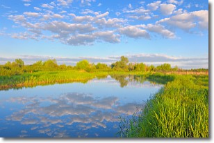
Stratocumulus clouds are similar to altocumulus clouds in their
fluffy appearance, but have a slightly darker shade due to their additional mass.
A good way to distinguish the two cloud types is to hold your hand out and measure
the size of an individual cloud; if it is the size of your thumb it is generally
an altocumulus cloud, if it is the size of your hand it is generally a
stratocumulus cloud.
It is uncommon for stratocumulus clouds to produce precipitation, but if they do
it is usually a light rain or snow.
Next Topic: Stratus Clouds
Weather Topic: What are Wall Clouds?
Home - Education - Cloud Types - Wall Clouds
 Next Topic: Altocumulus Clouds
A wall cloud forms underneath the base of a cumulonimbus cloud,
and can be a hotbed for deadly tornadoes.
Wall clouds are formed by air flowing into the cumulonimbus clouds, which can
result in the wall cloud descending from the base of the cumulonimbus cloud, or
rising fractus clouds which join to the base of the storm cloud as the wall cloud
takes shape.
Wall clouds can be very large, and in the Northern Hemisphere they generally
form at the southern edge of cumulonimbus clouds.
Next Topic: Altocumulus Clouds
Current conditions powered by WeatherAPI.com


