Weather Alert in California
Red Flag Warning issued July 23 at 12:31PM PDT until July 24 at 11:00PM PDT by NWS Eureka CA
AREAS AFFECTED: Upper Smith
DESCRIPTION: ...SCATTERED DRY THUNDERSTORMS POSSIBLE THURSDAY AFTERNOON AND EVENING AND FRIDAY ACROSS THE INTERIOR MOUNTAINS... .Scattered dry thunderstorms are forecast to develop in the Klamath Mountains Thursday afternoon and evening. The highest confidence of storms is in Siskiyou, Northern Humboldt, Eastern Del Norte, and Trinity counties. Some thunder potential also exists in southern Humboldt and in the Yolla Bollys. Thunderstorms are possible again on Friday, with storms possible further south into interior Mendocino and Northern Lake, along with interior Humboldt and Trinity Counties. The National Weather Service in Eureka has issued a Red Flag Warning, which is in effect from 11 AM to 11 PM PDT Thursday. The Fire Weather Watch is no longer in effect. * THUNDERSTORMS...Scattered thunderstorms are possible in the afternoon, mostly over the higher terrain. * OUTFLOW WINDS...Gusty and erratic outflow winds up to 40 mph are possible. * IMPACTS...Lightning strikes may start fires.
INSTRUCTION: A Red Flag Warning means that critical fire weather conditions are either occurring now, or will shortly. A combination of strong winds, low relative humidity, and warm temperatures can contribute to extreme fire behavior.
Want more detail? Get the Complete 7 Day and Night Detailed Forecast!
Current U.S. National Radar--Current
The Current National Weather Radar is shown below with a UTC Time (subtract 5 hours from UTC to get Eastern Time).

National Weather Forecast--Current
The Current National Weather Forecast and National Weather Map are shown below.

National Weather Forecast for Tomorrow
Tomorrow National Weather Forecast and Tomorrow National Weather Map are show below.

North America Water Vapor (Moisture)
This map shows recent moisture content over North America. Bright and colored areas show high moisture (ie, clouds); brown indicates very little moisture present; black indicates no moisture.

Weather Topic: What is Evaporation?
Home - Education - Precipitation - Evaporation
 Next Topic: Fog
Evaporation is the process which returns water from the earth
back to the atmosphere, and is another crucial process in the water cycle.
Evaporation is the transformation of liquid into gas, and it happens because
molecules are excited by the application of energy and turn into vapor.
In order for water to evaporate it has to be on the surface of a body of water.
Next Topic: Fog
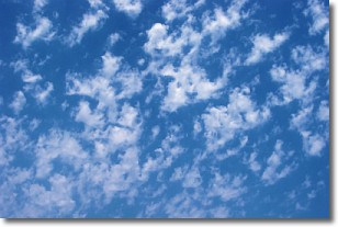
Weather Topic: What are Fractus Clouds?
Home - Education - Cloud Types - Fractus Clouds
 Next Topic: Freezing Rain
A fractus cloud (scud) is a fragmented, tattered cloud which has
likely been sheared off of another cloud. They are accessory clouds, meaning they
develop from parent clouds, and are named in a way which describes the original
cloud which contained them.
Fractus clouds which have originated from cumulus clouds are referred to as
cumulus fractus, while fractus clouds which have originated from stratus clouds
are referred to as stratus fractus. Under certain conditions a fractus cloud might
merge with another cloud, or develop into a cumulus cloud, but usually a
fractus cloud seen by itself will dissipate rapidly.
They are often observed on the leading and trailing edges of storm clouds,
and are a display of wind activity.
Next Topic: Freezing Rain
Current conditions powered by WeatherAPI.com


