Weather Alert in Indiana
Special Weather Statement issued February 6 at 2:58PM EST by NWS Louisville KY
AREAS AFFECTED: Orange; Washington; Scott; Jefferson; Dubois; Crawford; Perry; Harrison; Floyd; Clark; Hancock; Breckinridge; Meade; Ohio; Grayson; Hardin; Bullitt; Jefferson; Oldham; Trimble; Henry; Shelby; Franklin; Scott; Harrison; Spencer; Anderson; Woodford; Fayette; Bourbon; Nicholas; Nelson; Washington; Mercer; Jessamine; Clark; Larue; Marion; Boyle; Garrard; Madison; Butler; Edmonson; Hart; Green; Taylor; Casey; Lincoln; Logan; Warren; Simpson; Allen; Barren; Monroe; Metcalfe; Adair; Russell; Cumberland; Clinton
DESCRIPTION: Another Arctic cold front will drop into the region from the north tonight. Just ahead of the front, a band of snow showers and a few snow squalls are expected to drop southward through the region. The most favored time for this activity will be between 900 PM and 4 AM EST. Much of the snow shower activity will move across central and eastern Kentucky, mainly east of the I-65 corridor. Any accumulations look to be minimal and likely under a half of an inch. However, this snow falling at night and temperatures dropping into the 20s may result in areas of slick travel tonight along with reduced visibility within the snow showers. If you have travel plans for late tonight or early Saturday, you should exercise caution and allow extra time to reach your destination.
INSTRUCTION: N/A
Want more detail? Get the Complete 7 Day and Night Detailed Forecast!
Current U.S. National Radar--Current
The Current National Weather Radar is shown below with a UTC Time (subtract 5 hours from UTC to get Eastern Time).

National Weather Forecast--Current
The Current National Weather Forecast and National Weather Map are shown below.

National Weather Forecast for Tomorrow
Tomorrow National Weather Forecast and Tomorrow National Weather Map are show below.

North America Water Vapor (Moisture)
This map shows recent moisture content over North America. Bright and colored areas show high moisture (ie, clouds); brown indicates very little moisture present; black indicates no moisture.

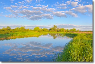
Weather Topic: What are Stratocumulus Clouds?
Home - Education - Cloud Types - Stratocumulus Clouds
 Next Topic: Stratus Clouds
Stratocumulus clouds are similar to altocumulus clouds in their
fluffy appearance, but have a slightly darker shade due to their additional mass.
A good way to distinguish the two cloud types is to hold your hand out and measure
the size of an individual cloud; if it is the size of your thumb it is generally
an altocumulus cloud, if it is the size of your hand it is generally a
stratocumulus cloud.
It is uncommon for stratocumulus clouds to produce precipitation, but if they do
it is usually a light rain or snow.
Next Topic: Stratus Clouds
Weather Topic: What are Wall Clouds?
Home - Education - Cloud Types - Wall Clouds
 Next Topic: Altocumulus Clouds
A wall cloud forms underneath the base of a cumulonimbus cloud,
and can be a hotbed for deadly tornadoes.
Wall clouds are formed by air flowing into the cumulonimbus clouds, which can
result in the wall cloud descending from the base of the cumulonimbus cloud, or
rising fractus clouds which join to the base of the storm cloud as the wall cloud
takes shape.
Wall clouds can be very large, and in the Northern Hemisphere they generally
form at the southern edge of cumulonimbus clouds.
Next Topic: Altocumulus Clouds
Current conditions powered by WeatherAPI.com


