Weather Alert in New Mexico
High Wind Watch issued February 18 at 8:51PM MST until February 20 at 8:00PM MST by NWS Midland/Odessa TX
AREAS AFFECTED: Guadalupe Mountains of Eddy County; Guadalupe Mountains Above 7000 Feet; Guadalupe and Delaware Mountains
DESCRIPTION: * WHAT...For the High Wind Warning, west winds 35 to 55 mph with gusts up to 75 mph. For the High Wind Watch, west winds 30 to 50 mph with gusts up to 70 mph possible. * WHERE...Guadalupe Mountains of west Texas and Southeast New Mexico. * WHEN...For the High Wind Warning, until 9 PM MST /10 PM CST/ Thursday. For the High Wind Watch, from Friday morning through Friday evening. * IMPACTS...Travel will be difficult, especially for high profile vehicles like campers, vans, and tractor trailers. Severe turbulence near the mountains will be hazardous for low flying light aircraft. Aviation interests may experience localized but extreme turbulence, or strong downward airflows if flying in the near the Guadalupe Mountains.
INSTRUCTION: Winds will be particularly hazardous at higher elevations where the strongest winds are likely to occur. Be especially careful driving in these mountainous areas. People driving high-profile vehicles should strongly consider postponing travel in these areas until the winds subside. Use caution when driving as blowing dust may reduce visibility. Monitor the latest forecasts and warnings for updates. Use caution if flying low near the mountains as severe turbulence is possible.
Want more detail? Get the Complete 7 Day and Night Detailed Forecast!
Current U.S. National Radar--Current
The Current National Weather Radar is shown below with a UTC Time (subtract 5 hours from UTC to get Eastern Time).

National Weather Forecast--Current
The Current National Weather Forecast and National Weather Map are shown below.

National Weather Forecast for Tomorrow
Tomorrow National Weather Forecast and Tomorrow National Weather Map are show below.

North America Water Vapor (Moisture)
This map shows recent moisture content over North America. Bright and colored areas show high moisture (ie, clouds); brown indicates very little moisture present; black indicates no moisture.

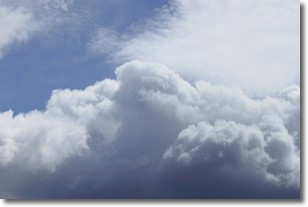
Weather Topic: What are Nimbostratus Clouds?
Home - Education - Cloud Types - Nimbostratus Clouds
 Next Topic: Precipitation
A nimbostratus cloud is similar to a stratus cloud in its formless,
smooth appearance. However, a nimbostratus cloud is darker than a stratus cloud,
because it is thicker.
Unlike a stratus cloud, a nimbostratus cloud typically brings with it the threat
of moderate to heavy precipitation. In some cases, the precipitation may evaporate
before reaching the ground, a phenomenon known as virga.
Next Topic: Precipitation
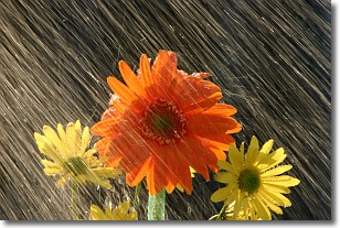
Weather Topic: What is Rain?
Home - Education - Precipitation - Rain
 Next Topic: Shelf Clouds
Precipitation in the form of water droplets is called rain.
Rain generally has a tendency to fall with less intensity over a greater period
of time, and when rainfall is more severe it is usually less sustained.
Rain is the most common form of precipitation and happens with greater frequency
depending on the season and regional influences. Cities have been shown to have
an observable effect on rainfall, due to an effect called the urban heat island.
Compared to upwind, monthly rainfall between twenty and forty miles downwind of
cities is 30% greater.
Next Topic: Shelf Clouds
Current conditions powered by WeatherAPI.com


