Weather Alert in Idaho
Winter Weather Advisory issued February 15 at 12:17PM MST until February 17 at 5:00PM MST by NWS Missoula MT
AREAS AFFECTED: Western Lemhi County; Eastern Lemhi County
DESCRIPTION: * WHAT...Snow expected. There is a likelihood moderate winter weather impacts. Total snow accumulations of 3 to 6 inches across area mountain passes, with up to 1 inch in lower elevations such as Salmon. * WHERE...Highway 93 Lost Trail Pass to Gibbonsville, Salmon, Shoup, Bannock Pass, Highway 28 Tendoy to Lone Pine, Williams Creek Summit, and Lemhi Pass. * WHEN...From 2 AM to 5 PM MST Tuesday. * IMPACTS...For MODERATE winter weather impacts, expect disruptions to normal activities. Hazardous traveling conditions. Use extra caution while driving. Closures and disruptions to infrastructure may occur. The hazardous conditions could impact the Tuesday morning and evening commutes, especially over higher passes. * ADDITIONAL DETAILS...Falling temperatures and snow levels will bring snow to elevations below 3,000 feet Tuesday morning. The cold front will bring an elevated risk for snow squalls capable of producing bursts of heavy snow and gusty winds across mountain areas, leading to brief whiteout conditions.
INSTRUCTION: Slow down and use caution while traveling. The latest road conditions for the state you are calling from can be obtained by calling 5 1 1.
Want more detail? Get the Complete 7 Day and Night Detailed Forecast!
Current U.S. National Radar--Current
The Current National Weather Radar is shown below with a UTC Time (subtract 5 hours from UTC to get Eastern Time).

National Weather Forecast--Current
The Current National Weather Forecast and National Weather Map are shown below.

National Weather Forecast for Tomorrow
Tomorrow National Weather Forecast and Tomorrow National Weather Map are show below.

North America Water Vapor (Moisture)
This map shows recent moisture content over North America. Bright and colored areas show high moisture (ie, clouds); brown indicates very little moisture present; black indicates no moisture.

Weather Topic: What are Cumulus Clouds?
Home - Education - Cloud Types - Cumulus Clouds
 Next Topic: Drizzle
Cumulus clouds are fluffy and textured with rounded tops, and
may have flat bottoms. The border of a cumulus cloud
is clearly defined, and can have the appearance of cotton or cauliflower.
Cumulus clouds form at low altitudes (rarely above 2 km) but can grow very tall,
becoming cumulus congestus and possibly the even taller cumulonimbus clouds.
When cumulus clouds become taller, they have a greater chance of producing precipitation.
Next Topic: Drizzle
Weather Topic: What is Evaporation?
Home - Education - Precipitation - Evaporation
 Next Topic: Fog
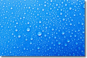
Evaporation is the process which returns water from the earth
back to the atmosphere, and is another crucial process in the water cycle.
Evaporation is the transformation of liquid into gas, and it happens because
molecules are excited by the application of energy and turn into vapor.
In order for water to evaporate it has to be on the surface of a body of water.
Next Topic: Fog
Current conditions powered by WeatherAPI.com


