Weather Alert in California
Winter Weather Advisory issued February 16 at 9:07PM PST until February 18 at 4:00PM PST by NWS San Francisco CA
AREAS AFFECTED: Santa Lucia Mountains and Los Padres National Forest; Mountains Of San Benito County And Interior Monterey County Including Pinnacles National Park
DESCRIPTION: ...WINTER WEATHER ADVISORY THROUGH WEDNESDAY AFTERNOON... Cold air will continue to move into the region tonight through Tuesday and Wednesday with accumulating snowfall expected across areas above 3000 feet in the Santa Lucia range and the mountains of San Benito and eastern Santa Clara Counties. Total snow accumulations range from 4 to 10 inches with the highest peaks reaching accumulations of 15 to 25 inches. If planning travel to the higher elevations of the Central Coast and eastern Santa Clara County, allow extra time to reach your destination safely. * WHAT...Accumulating snow for elevations above 3000 feet. Elevations below 3000 feet will see no accumulating snow to 3 inches. Above 3000 feet total snow accumulations of 5 to 10 inches and the highest peaks 15 to 25 inches. * WHERE...Elevations above 3000 feet for the Santa Lucia Mountains and the mountains of San Benito county. * WHEN...From 4 PM Monday to 4 PM PST Wednesday. * IMPACTS...Slick, snow-covered roads and hiking trails. Hikers, campers, outdoor enthusiasts may encounter dangerous winter conditions above the snow level. Heavier snow showers could produce limited visibilities. Downed trees and power outages possible. * ADDITIONAL IMPACTS...Wind gusts 50 to 60 mph above 2000 feet. The combination of wind and snow will reduce visibilities.
INSTRUCTION: N/A
Want more detail? Get the Complete 7 Day and Night Detailed Forecast!
Current U.S. National Radar--Current
The Current National Weather Radar is shown below with a UTC Time (subtract 5 hours from UTC to get Eastern Time).

National Weather Forecast--Current
The Current National Weather Forecast and National Weather Map are shown below.

National Weather Forecast for Tomorrow
Tomorrow National Weather Forecast and Tomorrow National Weather Map are show below.

North America Water Vapor (Moisture)
This map shows recent moisture content over North America. Bright and colored areas show high moisture (ie, clouds); brown indicates very little moisture present; black indicates no moisture.

Weather Topic: What is Evaporation?
Home - Education - Precipitation - Evaporation
 Next Topic: Fog
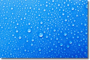
Evaporation is the process which returns water from the earth
back to the atmosphere, and is another crucial process in the water cycle.
Evaporation is the transformation of liquid into gas, and it happens because
molecules are excited by the application of energy and turn into vapor.
In order for water to evaporate it has to be on the surface of a body of water.
Next Topic: Fog
Weather Topic: What are Fractus Clouds?
Home - Education - Cloud Types - Fractus Clouds
 Next Topic: Freezing Rain
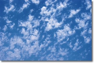
A fractus cloud (scud) is a fragmented, tattered cloud which has
likely been sheared off of another cloud. They are accessory clouds, meaning they
develop from parent clouds, and are named in a way which describes the original
cloud which contained them.
Fractus clouds which have originated from cumulus clouds are referred to as
cumulus fractus, while fractus clouds which have originated from stratus clouds
are referred to as stratus fractus. Under certain conditions a fractus cloud might
merge with another cloud, or develop into a cumulus cloud, but usually a
fractus cloud seen by itself will dissipate rapidly.
They are often observed on the leading and trailing edges of storm clouds,
and are a display of wind activity.
Next Topic: Freezing Rain
Current conditions powered by WeatherAPI.com


