Weather Alert in Colorado
Winter Weather Advisory issued February 16 at 11:52AM MST until February 18 at 11:00PM MST by NWS Denver CO
AREAS AFFECTED: South and East Jackson/Larimer/North and Northeast Grand/Northwest Boulder Counties Above 9000 Feet; South and Southeast Grand/West Central and Southwest Boulder/Gilpin/Clear Creek/Summit/North and West Park Counties Above 9000 Feet
DESCRIPTION: * WHAT...Snow expected. Total snow accumulations between 5 and 12 inches, with localized higher amounts up to 16 inches. Winds gusting as high as 70 mph. * WHERE...Rocky Mountain National Park and the Medicine Bow Range, and The Mountains of Summit County, the Mosquito Range, and the Indian Peaks. * WHEN...From 2 AM Tuesday to 11 PM MST Wednesday. * IMPACTS...Snow and blowing snow will reduce visibility to a quarter mile or less, with potential for sudden snow squalls to bring quick intense bursts of snow, rapidly reduced visibility and treacherous travel conditions. Travel could be very difficult to impossible. The hazardous conditions will impact the Tuesday morning and evening commutes.
INSTRUCTION: Roads will be slick resulting in slow and hazardous travel. Allow extra time to reach your destination. If traveling to the mountains, be prepared for winter driving conditions. Check cotrip.org for road closures and traction laws.
Want more detail? Get the Complete 7 Day and Night Detailed Forecast!
Current U.S. National Radar--Current
The Current National Weather Radar is shown below with a UTC Time (subtract 5 hours from UTC to get Eastern Time).

National Weather Forecast--Current
The Current National Weather Forecast and National Weather Map are shown below.

National Weather Forecast for Tomorrow
Tomorrow National Weather Forecast and Tomorrow National Weather Map are show below.

North America Water Vapor (Moisture)
This map shows recent moisture content over North America. Bright and colored areas show high moisture (ie, clouds); brown indicates very little moisture present; black indicates no moisture.

Weather Topic: What are Hole Punch Clouds?
Home - Education - Cloud Types - Hole Punch Clouds
 Next Topic: Mammatus Clouds
A hole punch cloud is an unusual occurrence when a disk-shaped
hole appears in a cirrostratus, cirrocumulus, or altocumulus cloud.
When part of the cloud forms ice crystals, water droplets in the surrounding area
of the cloud evaporate. The effect of this process produces a large elliptical
gap in the cloud. The hole punch cloud formation is rare, but it is not specific
to any geographic area.
Other names which have been used to describe this phenomena include fallstreak hole,
skypunch, and cloud hole.
Next Topic: Mammatus Clouds
Weather Topic: What are Nimbostratus Clouds?
Home - Education - Cloud Types - Nimbostratus Clouds
 Next Topic: Precipitation
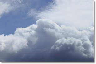
A nimbostratus cloud is similar to a stratus cloud in its formless,
smooth appearance. However, a nimbostratus cloud is darker than a stratus cloud,
because it is thicker.
Unlike a stratus cloud, a nimbostratus cloud typically brings with it the threat
of moderate to heavy precipitation. In some cases, the precipitation may evaporate
before reaching the ground, a phenomenon known as virga.
Next Topic: Precipitation
Current conditions powered by WeatherAPI.com


