Weather Alert in Michigan
Special Weather Statement issued February 6 at 4:33AM EST by NWS Detroit/Pontiac MI
AREAS AFFECTED: Midland; Bay; Huron; Saginaw; Tuscola; Sanilac; Shiawassee; Genesee; Lapeer; St. Clair; Livingston; Oakland; Macomb; Washtenaw; Wayne; Lenawee; Monroe
DESCRIPTION: WEATHER... * Areas of light freezing drizzle will continue impact southeastern Michigan early this morning before transitioning to light snow between 4 to 6 AM. * Snow accumulations around 1 inch are possible for most areas by midday. Areas south of I-96 have the best chance to see higher totals up to 2 inches. * Southwest winds around 5 mph with gusts to 15 mph. * Air temperatures will rise from lower 20s to lower 30 degrees later this morning. IMPACTS... * Light icing or snow will lead to slippery roads particularly on bridges, exit ramps and overpasses. * Reductions of visibility to less than one mile are also possible in heavier snow showers.
INSTRUCTION: * Area of light freezing drizzle means areal coverage or duration of the freezing drizzle will be limited. Motorists are urged to use caution and account for variable driving conditions by slowing down and allowing extra time. * Prepare, plan and stay informed. Visit http://go.usa.gov/c7kkP
Want more detail? Get the Complete 7 Day and Night Detailed Forecast!
Current U.S. National Radar--Current
The Current National Weather Radar is shown below with a UTC Time (subtract 5 hours from UTC to get Eastern Time).

National Weather Forecast--Current
The Current National Weather Forecast and National Weather Map are shown below.

National Weather Forecast for Tomorrow
Tomorrow National Weather Forecast and Tomorrow National Weather Map are show below.

North America Water Vapor (Moisture)
This map shows recent moisture content over North America. Bright and colored areas show high moisture (ie, clouds); brown indicates very little moisture present; black indicates no moisture.

Weather Topic: What are Hole Punch Clouds?
Home - Education - Cloud Types - Hole Punch Clouds
 Next Topic: Mammatus Clouds
A hole punch cloud is an unusual occurrence when a disk-shaped
hole appears in a cirrostratus, cirrocumulus, or altocumulus cloud.
When part of the cloud forms ice crystals, water droplets in the surrounding area
of the cloud evaporate. The effect of this process produces a large elliptical
gap in the cloud. The hole punch cloud formation is rare, but it is not specific
to any geographic area.
Other names which have been used to describe this phenomena include fallstreak hole,
skypunch, and cloud hole.
Next Topic: Mammatus Clouds
Weather Topic: What are Nimbostratus Clouds?
Home - Education - Cloud Types - Nimbostratus Clouds
 Next Topic: Precipitation
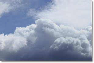
A nimbostratus cloud is similar to a stratus cloud in its formless,
smooth appearance. However, a nimbostratus cloud is darker than a stratus cloud,
because it is thicker.
Unlike a stratus cloud, a nimbostratus cloud typically brings with it the threat
of moderate to heavy precipitation. In some cases, the precipitation may evaporate
before reaching the ground, a phenomenon known as virga.
Next Topic: Precipitation
Current conditions powered by WeatherAPI.com


