Weather Alert in Alaska
Cold Weather Advisory issued February 28 at 2:43PM AKST until March 1 at 11:00AM AKST by NWS Anchorage AK
AREAS AFFECTED: SW Kenai Peninsula; Southern Kenai Mtns; West Prince William Sound & Whittier; Valdez
DESCRIPTION: * WHAT...Very cold wind chills of 10 below to 25 below zero expected. * WHERE...Southwest Kenai Peninsula, Seward and vicinity, Whittier, and Valdez. * WHEN...From 8 PM this evening to 11 AM AKST Sunday. * IMPACTS...The very cold wind chills as low as 25 below zero could cause frostbite on exposed skin in as little as 20 minutes. Frostbite and hypothermia are likely if exposed to these temperatures. * ADDITIONAL DETAILS...Northerly winds (except westerly winds in Whittier) will strengthen this evening into the overnight hours, leading to rapidly falling wind chills. Winds will slowly diminish on Sunday.
INSTRUCTION: Use caution while traveling outside. Wear appropriate clothing, a hat, and gloves.
Want more detail? Get the Complete 7 Day and Night Detailed Forecast!
Current U.S. National Radar--Current
The Current National Weather Radar is shown below with a UTC Time (subtract 5 hours from UTC to get Eastern Time).

National Weather Forecast--Current
The Current National Weather Forecast and National Weather Map are shown below.

National Weather Forecast for Tomorrow
Tomorrow National Weather Forecast and Tomorrow National Weather Map are show below.

North America Water Vapor (Moisture)
This map shows recent moisture content over North America. Bright and colored areas show high moisture (ie, clouds); brown indicates very little moisture present; black indicates no moisture.

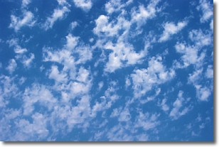
Weather Topic: What are Fractus Clouds?
Home - Education - Cloud Types - Fractus Clouds
 Next Topic: Freezing Rain
A fractus cloud (scud) is a fragmented, tattered cloud which has
likely been sheared off of another cloud. They are accessory clouds, meaning they
develop from parent clouds, and are named in a way which describes the original
cloud which contained them.
Fractus clouds which have originated from cumulus clouds are referred to as
cumulus fractus, while fractus clouds which have originated from stratus clouds
are referred to as stratus fractus. Under certain conditions a fractus cloud might
merge with another cloud, or develop into a cumulus cloud, but usually a
fractus cloud seen by itself will dissipate rapidly.
They are often observed on the leading and trailing edges of storm clouds,
and are a display of wind activity.
Next Topic: Freezing Rain
Weather Topic: What is Graupel?
Home - Education - Precipitation - Graupel
 Next Topic: Hail
Graupel is a form of precipitation that is created by atmospheric conditions
which cause supercooled water droplets to contact snow crystals and freeze to
their surface.
Sometimes known as soft hail or snow pellets, graupel is delicate and easily
destroyed by touch. Whereas hail usually falls during severe weather, graupel
doesn't require such conditions to form, and can form in mild precipitation
similar to situations which produce snowfall.
Next Topic: Hail
Current conditions powered by WeatherAPI.com


