Weather Alert in New Mexico
Fire Weather Watch issued March 20 at 1:23PM MDT until March 22 at 8:00PM MDT by NWS Albuquerque NM
AREAS AFFECTED: Northeast Plains; East Central Plains
DESCRIPTION: ...FIRE WEATHER WATCH SUNDAY FROM NOON UNTIL 8 PM MDT FOR THE NORTHEAST AND EAST CENTRAL PLAINS DUE TO STRONG WIND AND LOW HUMIDITY... .A very dry backdoor cold front will enter the eastern plains on Sunday with northeast wind gusts up to 40 mph. Even with cooling temperatures, the afternoon humidity will plummet below 10% Sunday afternoon. These windy and dry conditions combined with very dry fuels will increase the risk of rapid fire spread. * AREA AND TIMING...Northeast Plains (Zone 104) and East Central Plains (Zone 126) Sunday from noon until 8 PM MDT. * 20 FOOT WINDS...Northeast 20 to 30 mph with gusts up to 40 mph. * RELATIVE HUMIDITY...Minimum values between 5 and 9 percent, except 9 to 13 percent in Union County. * IMPACTS...Any fires that develop will likely spread rapidly. Outdoor burning is not recommended..
INSTRUCTION: Please advise the appropriate officials or fire crews in the field of this Fire Weather Watch.
Want more detail? Get the Complete 7 Day and Night Detailed Forecast!
Current U.S. National Radar--Current
The Current National Weather Radar is shown below with a UTC Time (subtract 5 hours from UTC to get Eastern Time).

National Weather Forecast--Current
The Current National Weather Forecast and National Weather Map are shown below.

National Weather Forecast for Tomorrow
Tomorrow National Weather Forecast and Tomorrow National Weather Map are show below.

North America Water Vapor (Moisture)
This map shows recent moisture content over North America. Bright and colored areas show high moisture (ie, clouds); brown indicates very little moisture present; black indicates no moisture.

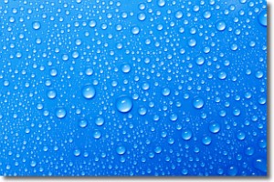
Weather Topic: What is Evaporation?
Home - Education - Precipitation - Evaporation
 Next Topic: Fog
Evaporation is the process which returns water from the earth
back to the atmosphere, and is another crucial process in the water cycle.
Evaporation is the transformation of liquid into gas, and it happens because
molecules are excited by the application of energy and turn into vapor.
In order for water to evaporate it has to be on the surface of a body of water.
Next Topic: Fog
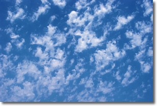
Weather Topic: What are Fractus Clouds?
Home - Education - Cloud Types - Fractus Clouds
 Next Topic: Freezing Rain
A fractus cloud (scud) is a fragmented, tattered cloud which has
likely been sheared off of another cloud. They are accessory clouds, meaning they
develop from parent clouds, and are named in a way which describes the original
cloud which contained them.
Fractus clouds which have originated from cumulus clouds are referred to as
cumulus fractus, while fractus clouds which have originated from stratus clouds
are referred to as stratus fractus. Under certain conditions a fractus cloud might
merge with another cloud, or develop into a cumulus cloud, but usually a
fractus cloud seen by itself will dissipate rapidly.
They are often observed on the leading and trailing edges of storm clouds,
and are a display of wind activity.
Next Topic: Freezing Rain
Current conditions powered by WeatherAPI.com


