Weather Alert in Louisiana
Special Weather Statement issued March 16 at 2:13AM CDT by NWS New Orleans LA
AREAS AFFECTED: St. John The Baptist; Upper Lafourche; St. Charles; Upper St. Bernard; Upper Terrebonne; Lower Terrebonne; Lower Lafourche; Coastal Jefferson; Lower Plaquemines; Lower St. Bernard; Western Orleans; Eastern Orleans; Upper Jefferson; Lower Jefferson; Upper Plaquemines; Central Plaquemines
DESCRIPTION: At 213 AM CDT, Doppler radar was tracking strong thunderstorms along a line extending from 11 miles south of Madisonville to 20 miles south of Amelia. Movement was east at 45 mph. HAZARD...Winds in excess of 40 mph. SOURCE...Radar indicated. IMPACT...Gusty winds could knock down tree limbs and blow around unsecured objects. Locations impacted include... New Orleans, Kenner, Houma, Thibodaux, Cut Off, Metairie, Hahnville, Marrero, Chalmette, Galliano, Avondale, Larose, Harvey, East New Orleans, Timberlane, Belle Chasse, Laplace, Jefferson, Gretna, and Harahan. This includes the following Interstates... Interstate 10 in Louisiana between mile markers 210 and 255. Interstate 310 between mile markers 1 and 11. Interstate 510 between mile markers 1 and 3. Interstate 610 between mile markers 1 and 4.
INSTRUCTION: If outdoors, consider seeking shelter inside a building. Frequent cloud to ground lightning is occurring with these storms. Lightning can strike 10 miles away from a thunderstorm. Seek a safe shelter inside a building or vehicle. These storms may intensify, so be certain to monitor local radio stations and available television stations for additional information and possible warnings from the National Weather Service. A Tornado Watch remains in effect until 400 AM CDT for southeastern Louisiana.
Want more detail? Get the Complete 7 Day and Night Detailed Forecast!
Current U.S. National Radar--Current
The Current National Weather Radar is shown below with a UTC Time (subtract 5 hours from UTC to get Eastern Time).

National Weather Forecast--Current
The Current National Weather Forecast and National Weather Map are shown below.

National Weather Forecast for Tomorrow
Tomorrow National Weather Forecast and Tomorrow National Weather Map are show below.

North America Water Vapor (Moisture)
This map shows recent moisture content over North America. Bright and colored areas show high moisture (ie, clouds); brown indicates very little moisture present; black indicates no moisture.

Weather Topic: What is Evaporation?
Home - Education - Precipitation - Evaporation
 Next Topic: Fog
Evaporation is the process which returns water from the earth
back to the atmosphere, and is another crucial process in the water cycle.
Evaporation is the transformation of liquid into gas, and it happens because
molecules are excited by the application of energy and turn into vapor.
In order for water to evaporate it has to be on the surface of a body of water.
Next Topic: Fog
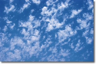
Weather Topic: What are Fractus Clouds?
Home - Education - Cloud Types - Fractus Clouds
 Next Topic: Freezing Rain
A fractus cloud (scud) is a fragmented, tattered cloud which has
likely been sheared off of another cloud. They are accessory clouds, meaning they
develop from parent clouds, and are named in a way which describes the original
cloud which contained them.
Fractus clouds which have originated from cumulus clouds are referred to as
cumulus fractus, while fractus clouds which have originated from stratus clouds
are referred to as stratus fractus. Under certain conditions a fractus cloud might
merge with another cloud, or develop into a cumulus cloud, but usually a
fractus cloud seen by itself will dissipate rapidly.
They are often observed on the leading and trailing edges of storm clouds,
and are a display of wind activity.
Next Topic: Freezing Rain
Current conditions powered by WeatherAPI.com


