Weather Alert in Kentucky
Special Weather Statement issued September 5 at 9:53PM EDT by NWS Jackson KY
AREAS AFFECTED: Rockcastle; Jackson; Pulaski; Laurel
DESCRIPTION: At 953 PM EDT, Doppler radar was tracking strong thunderstorms along a line extending from Morrill to near Dabney. Movement was east at 50 mph. HAZARD...Wind gusts up to 50 mph and penny size hail. SOURCE...Radar indicated. IMPACT...Gusty winds could knock down tree limbs and blow around unsecured objects. Minor damage to outdoor objects is possible. Locations impacted include... Mount Vernon, McKee, Boone, Science Hill, Donaro, Bummer, Robinet, Gum Sulphur, Shop Branch, Bandy, Privett, Horse Lick, Spiro, Climax, Renfro Valley, Disputanta, Mershons, Hazel Patch, Pine Hill, and Camp Wildcat. THIS INCLUDES THE FOLLOWING HIGHWAYS... Interstate 75 in east central Kentucky between mile markers 42 and 72. Kentucky Highway 80 in Laurel County between mile markers 1 and 10. Kentucky Highway 80 in Pulaski County between mile markers 26 and 40.
INSTRUCTION: If outdoors, consider seeking shelter inside a building. Torrential rainfall is also occurring with these storms and may lead to localized flooding. Do not drive your vehicle through flooded roadways. A Severe Thunderstorm Watch remains in effect until 100 AM EDT for south central and southeastern Kentucky.
Want more detail? Get the Complete 7 Day and Night Detailed Forecast!
Current U.S. National Radar--Current
The Current National Weather Radar is shown below with a UTC Time (subtract 5 hours from UTC to get Eastern Time).

National Weather Forecast--Current
The Current National Weather Forecast and National Weather Map are shown below.

National Weather Forecast for Tomorrow
Tomorrow National Weather Forecast and Tomorrow National Weather Map are show below.

North America Water Vapor (Moisture)
This map shows recent moisture content over North America. Bright and colored areas show high moisture (ie, clouds); brown indicates very little moisture present; black indicates no moisture.

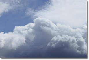
Weather Topic: What are Nimbostratus Clouds?
Home - Education - Cloud Types - Nimbostratus Clouds
 Next Topic: Precipitation
A nimbostratus cloud is similar to a stratus cloud in its formless,
smooth appearance. However, a nimbostratus cloud is darker than a stratus cloud,
because it is thicker.
Unlike a stratus cloud, a nimbostratus cloud typically brings with it the threat
of moderate to heavy precipitation. In some cases, the precipitation may evaporate
before reaching the ground, a phenomenon known as virga.
Next Topic: Precipitation
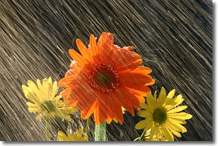
Weather Topic: What is Rain?
Home - Education - Precipitation - Rain
 Next Topic: Shelf Clouds
Precipitation in the form of water droplets is called rain.
Rain generally has a tendency to fall with less intensity over a greater period
of time, and when rainfall is more severe it is usually less sustained.
Rain is the most common form of precipitation and happens with greater frequency
depending on the season and regional influences. Cities have been shown to have
an observable effect on rainfall, due to an effect called the urban heat island.
Compared to upwind, monthly rainfall between twenty and forty miles downwind of
cities is 30% greater.
Next Topic: Shelf Clouds
Current conditions powered by WeatherAPI.com


