Weather Alert in Kentucky
Severe Thunderstorm Warning issued March 16 at 3:51AM EDT until March 16 at 4:30AM EDT by NWS Jackson KY
AREAS AFFECTED: Elliott, KY; Johnson, KY; Magoffin, KY; Martin, KY; Morgan, KY
DESCRIPTION: SVRJKL The National Weather Service in JACKSON KY has issued a * Severe Thunderstorm Warning for... Martin County in northeastern Kentucky... Southeastern Morgan County in southeastern Kentucky... Johnson County in northeastern Kentucky... Northern Magoffin County in southeastern Kentucky... Central Elliott County in east central Kentucky... * Until 430 AM EDT. * At 351 AM EDT, severe thunderstorms were located along a line extending from Newfoundland to Hager, moving east at 40 mph. HAZARD...60 mph wind gusts. SOURCE...Radar indicated. IMPACT...Expect damage to roofs, siding, and trees. * Severe thunderstorms will be near... Salyersville around 355 AM EDT. Elna around 400 AM EDT. Flatgap around 405 AM EDT. Paintsville around 410 AM EDT. Other locations in the path of these severe thunderstorms include Stambaugh and Perston Estates.
INSTRUCTION: For your protection move to an interior room on the lowest floor of a building. Intense thunderstorm lines can produce brief tornadoes and widespread significant wind damage. Although a tornado is not immediately likely, it is best to move to an interior room on the lowest floor of a building. These storms may cause serious injury and significant property damage.
Want more detail? Get the Complete 7 Day and Night Detailed Forecast!
Current U.S. National Radar--Current
The Current National Weather Radar is shown below with a UTC Time (subtract 5 hours from UTC to get Eastern Time).

National Weather Forecast--Current
The Current National Weather Forecast and National Weather Map are shown below.

National Weather Forecast for Tomorrow
Tomorrow National Weather Forecast and Tomorrow National Weather Map are show below.

North America Water Vapor (Moisture)
This map shows recent moisture content over North America. Bright and colored areas show high moisture (ie, clouds); brown indicates very little moisture present; black indicates no moisture.

Weather Topic: What are Hole Punch Clouds?
Home - Education - Cloud Types - Hole Punch Clouds
 Next Topic: Mammatus Clouds
A hole punch cloud is an unusual occurrence when a disk-shaped
hole appears in a cirrostratus, cirrocumulus, or altocumulus cloud.
When part of the cloud forms ice crystals, water droplets in the surrounding area
of the cloud evaporate. The effect of this process produces a large elliptical
gap in the cloud. The hole punch cloud formation is rare, but it is not specific
to any geographic area.
Other names which have been used to describe this phenomena include fallstreak hole,
skypunch, and cloud hole.
Next Topic: Mammatus Clouds
Weather Topic: What are Nimbostratus Clouds?
Home - Education - Cloud Types - Nimbostratus Clouds
 Next Topic: Precipitation
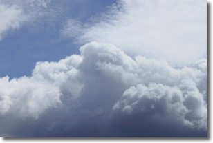
A nimbostratus cloud is similar to a stratus cloud in its formless,
smooth appearance. However, a nimbostratus cloud is darker than a stratus cloud,
because it is thicker.
Unlike a stratus cloud, a nimbostratus cloud typically brings with it the threat
of moderate to heavy precipitation. In some cases, the precipitation may evaporate
before reaching the ground, a phenomenon known as virga.
Next Topic: Precipitation
Current conditions powered by WeatherAPI.com


