Weather Alert in Illinois
Flood Warning issued March 15 at 10:29PM EDT until March 22 at 3:12PM EDT by NWS Indianapolis IN
AREAS AFFECTED: Edwards, IL; Gallatin, IL; Wabash, IL; White, IL; Gibson, IN; Knox, IN; Posey, IN
DESCRIPTION: ...The Flood Warning is extended for the following rivers in Indiana... East Fork White River near Bedford and Rivervale. White River at Petersburg. ...The Flood Warning continues for the following rivers in Indiana... Illinois... East Fork White River at Williams. White River at Hazleton. Wabash River at Mount Carmel. .Flooding continues on lower portions of the Wabash, White, and East Fork White rivers in central and southern Indiana as a result of excessive rainfall. Flooding remains confined on the Wabash to the Mount Carmel area and is expected to continue until next weekend. Flooding on the White River is expected to last as long as March 25 at Hazleton. Flooding on the East Fork White River should conclude by the middle of this week. Bankfull conditions are expected otherwise from Rivervale to Williams through midweek. Negligible precipitation is predicted to fall over the next seven days, allowing the rivers to continue to fall, with only a minor bump from Sunday evening's rainfall. * WHAT...Minor flooding is occurring and minor flooding is forecast. * WHERE...Wabash River at Mount Carmel. * WHEN...Until Sunday, March 22. * IMPACTS...At 22.9 feet, Water begins to flow over River Road just north of Fifth Street in the Mount Carmel area. * ADDITIONAL DETAILS... - At 9:45 PM EDT Sunday /8:45 PM CDT Sunday/ the stage was 23.0 feet. - Recent Activity...The maximum river stage in the 24 hours ending at 9:45 PM EDT Sunday /8:45 PM CDT Sunday/ was 23.4 feet. - Forecast...The river is expected to rise to a crest of 23.0 feet just after midnight tonight. It will then fall below flood stage Sunday, March 22. - Flood stage is 19.0 feet. - http://www.weather.gov/safety/flood
INSTRUCTION: Be especially cautious at night when it is harder to recognize the dangers of flooding. Flooding is occurring or is imminent. Most flood related deaths occur in automobiles. Do not attempt to cross water covered bridges, dips, or low water crossings. Never try to cross a flowing stream, even a small one, on foot. To escape rising water find another route over higher ground. Additional information is available at www.weather.gov/ind. The next statement should be issued Monday afternoon by around 300 PM EDT /200 PM CDT/.
Want more detail? Get the Complete 7 Day and Night Detailed Forecast!
Current U.S. National Radar--Current
The Current National Weather Radar is shown below with a UTC Time (subtract 5 hours from UTC to get Eastern Time).

National Weather Forecast--Current
The Current National Weather Forecast and National Weather Map are shown below.

National Weather Forecast for Tomorrow
Tomorrow National Weather Forecast and Tomorrow National Weather Map are show below.

North America Water Vapor (Moisture)
This map shows recent moisture content over North America. Bright and colored areas show high moisture (ie, clouds); brown indicates very little moisture present; black indicates no moisture.

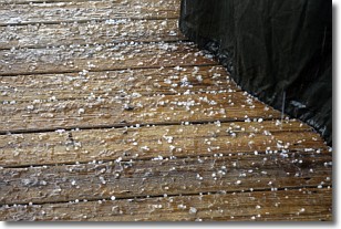
Weather Topic: What is Sleet?
Home - Education - Precipitation - Sleet
 Next Topic: Snow
Sleet is a form of precipitation in which small ice pellets are the primary
components. These ice pellets are smaller and more translucent than hailstones,
and harder than graupel. Sleet is caused by specific atmospheric conditions and
therefore typically doesn't last for extended periods of time.
The condition which leads to sleet formation requires a warmer body of air to be
wedged in between two sub-freezing bodies of air. When snow falls through a warmer
layer of air it melts, and as it falls through the next sub-freezing body of air
it freezes again, forming ice pellets known as sleet. In some cases, water
droplets don't have time to freeze before reaching the surface and the result is
freezing rain.
Next Topic: Snow
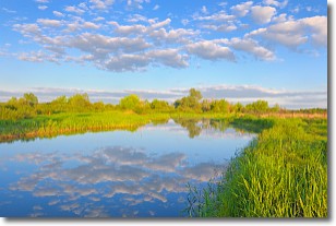
Weather Topic: What are Stratocumulus Clouds?
Home - Education - Cloud Types - Stratocumulus Clouds
 Next Topic: Stratus Clouds
Stratocumulus clouds are similar to altocumulus clouds in their
fluffy appearance, but have a slightly darker shade due to their additional mass.
A good way to distinguish the two cloud types is to hold your hand out and measure
the size of an individual cloud; if it is the size of your thumb it is generally
an altocumulus cloud, if it is the size of your hand it is generally a
stratocumulus cloud.
It is uncommon for stratocumulus clouds to produce precipitation, but if they do
it is usually a light rain or snow.
Next Topic: Stratus Clouds
Current conditions powered by WeatherAPI.com


