Weather Alert in North Carolina
Special Weather Statement issued March 22 at 2:28PM EDT by NWS Greenville-Spartanburg SC
AREAS AFFECTED: Alexander; Iredell; Davie; Catawba; Rowan; Cleveland; Lincoln; Gaston; Mecklenburg; Cabarrus; Union; Greater Caldwell; Greater Burke; Eastern McDowell; Greater Rutherford; Eastern Polk; Cherokee; York; Anderson; Abbeville; Laurens; Union; Chester; Greenwood; Oconee Mountains; Pickens Mountains; Greenville Mountains; Greater Oconee; Greater Pickens; Central Greenville; Southern Greenville; Northern Spartanburg; Southern Spartanburg
DESCRIPTION: Dry brush and leaf litter have become very dry in recent days due to breezy conditions and low relative humidity. These conditions are forecast again tomorrow. Relative humidity will fall below 30 percent for much of the afternoon and wind gusts may reach 25 mph at times. Given the dry vegetation, outdoor fires will be able to spread quickly once started, increasing the danger of wildfires. Please refer to your local burn permitting authorities on whether you can burn today. If you do burn, use extreme caution since fires can quickly get out of hand under these conditions.
INSTRUCTION: N/A
Want more detail? Get the Complete 7 Day and Night Detailed Forecast!
Current U.S. National Radar--Current
The Current National Weather Radar is shown below with a UTC Time (subtract 5 hours from UTC to get Eastern Time).

National Weather Forecast--Current
The Current National Weather Forecast and National Weather Map are shown below.

National Weather Forecast for Tomorrow
Tomorrow National Weather Forecast and Tomorrow National Weather Map are show below.

North America Water Vapor (Moisture)
This map shows recent moisture content over North America. Bright and colored areas show high moisture (ie, clouds); brown indicates very little moisture present; black indicates no moisture.

Weather Topic: What are Cumulus Clouds?
Home - Education - Cloud Types - Cumulus Clouds
 Next Topic: Drizzle
Cumulus clouds are fluffy and textured with rounded tops, and
may have flat bottoms. The border of a cumulus cloud
is clearly defined, and can have the appearance of cotton or cauliflower.
Cumulus clouds form at low altitudes (rarely above 2 km) but can grow very tall,
becoming cumulus congestus and possibly the even taller cumulonimbus clouds.
When cumulus clouds become taller, they have a greater chance of producing precipitation.
Next Topic: Drizzle
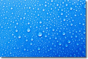
Weather Topic: What is Evaporation?
Home - Education - Precipitation - Evaporation
 Next Topic: Fog
Evaporation is the process which returns water from the earth
back to the atmosphere, and is another crucial process in the water cycle.
Evaporation is the transformation of liquid into gas, and it happens because
molecules are excited by the application of energy and turn into vapor.
In order for water to evaporate it has to be on the surface of a body of water.
Next Topic: Fog
Current conditions powered by WeatherAPI.com


