Weather Alert in North Carolina
Special Weather Statement issued March 22 at 2:28PM EDT by NWS Greenville-Spartanburg SC
AREAS AFFECTED: Alexander; Iredell; Davie; Catawba; Rowan; Cleveland; Lincoln; Gaston; Mecklenburg; Cabarrus; Union; Greater Caldwell; Greater Burke; Eastern McDowell; Greater Rutherford; Eastern Polk; Cherokee; York; Anderson; Abbeville; Laurens; Union; Chester; Greenwood; Oconee Mountains; Pickens Mountains; Greenville Mountains; Greater Oconee; Greater Pickens; Central Greenville; Southern Greenville; Northern Spartanburg; Southern Spartanburg
DESCRIPTION: Dry brush and leaf litter have become very dry in recent days due to breezy conditions and low relative humidity. These conditions are forecast again tomorrow. Relative humidity will fall below 30 percent for much of the afternoon and wind gusts may reach 25 mph at times. Given the dry vegetation, outdoor fires will be able to spread quickly once started, increasing the danger of wildfires. Please refer to your local burn permitting authorities on whether you can burn today. If you do burn, use extreme caution since fires can quickly get out of hand under these conditions.
INSTRUCTION: N/A
Want more detail? Get the Complete 7 Day and Night Detailed Forecast!
Current U.S. National Radar--Current
The Current National Weather Radar is shown below with a UTC Time (subtract 5 hours from UTC to get Eastern Time).

National Weather Forecast--Current
The Current National Weather Forecast and National Weather Map are shown below.

National Weather Forecast for Tomorrow
Tomorrow National Weather Forecast and Tomorrow National Weather Map are show below.

North America Water Vapor (Moisture)
This map shows recent moisture content over North America. Bright and colored areas show high moisture (ie, clouds); brown indicates very little moisture present; black indicates no moisture.

Weather Topic: What are Stratocumulus Clouds?
Home - Education - Cloud Types - Stratocumulus Clouds
 Next Topic: Stratus Clouds
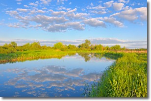
Stratocumulus clouds are similar to altocumulus clouds in their
fluffy appearance, but have a slightly darker shade due to their additional mass.
A good way to distinguish the two cloud types is to hold your hand out and measure
the size of an individual cloud; if it is the size of your thumb it is generally
an altocumulus cloud, if it is the size of your hand it is generally a
stratocumulus cloud.
It is uncommon for stratocumulus clouds to produce precipitation, but if they do
it is usually a light rain or snow.
Next Topic: Stratus Clouds
Weather Topic: What are Wall Clouds?
Home - Education - Cloud Types - Wall Clouds
 Next Topic: Altocumulus Clouds
A wall cloud forms underneath the base of a cumulonimbus cloud,
and can be a hotbed for deadly tornadoes.
Wall clouds are formed by air flowing into the cumulonimbus clouds, which can
result in the wall cloud descending from the base of the cumulonimbus cloud, or
rising fractus clouds which join to the base of the storm cloud as the wall cloud
takes shape.
Wall clouds can be very large, and in the Northern Hemisphere they generally
form at the southern edge of cumulonimbus clouds.
Next Topic: Altocumulus Clouds
Current conditions powered by WeatherAPI.com


