Weather Alert in Michigan
Air Quality Alert issued July 25 at 11:44AM EDT by NWS Marquette MI
AREAS AFFECTED: Keweenaw; Ontonagon; Houghton; Baraga; Marquette; Alger; Luce; Gogebic; Iron; Dickinson; Menominee; Delta; Southern Schoolcraft; Southern Houghton; Northern Schoolcraft
DESCRIPTION: The Michigan Department of Environment, Great Lakes, and Energy (EGLE) has issued an Air Quality Advisory for elevated levels of fine particulates (PM2.5) in the Upper Peninsula of Michigan starting at 3 PM EDT Thursday. Pollutants are expected to be in the Unhealthy for Sensitive Groups (USG, Orange AQI) range. The Air Quality Advisory is in effect for the following Michigan Counties, Keweenaw, Menominee, Dickinson, Iron, Marquette, Baraga, Northern Houghton, Southern Schoolcraft, Ontonagon, Delta, Gogebic, Luce, Alger, Northern Schoolcraft, and Southern Houghton. Smoke from Canadian wildfires moved into the Upper Peninsula Thursday. Models show the plume moving southeast, reaching the northern portions of the Lower Peninsula this morning and continuing towards the central portion of the state. As the smoke moves in, we anticipate PM2.5 to increase into the Unhealthy for Sensitive Groups (USG) range. There is a possibility that hourly levels could reach the Unhealthy (red AQI) range for a short period of time. It is recommended that, when possible, you avoid strenuous outdoor activities, especially those with heart disease and respiratory diseases such as asthma. Monitor for symptoms such as wheezing, coughing, chest tightness, dizziness, or burning in nose, throat, and eyes. Reduce or eliminate activities that contribute to air pollution, such as outdoor burning, and use of residential wood burning devices. Keep windows closed overnight to prevent smoke from getting indoors and, if possible, run central air conditioning with MERV-13 or higher rated filters. For up-to-date air quality data for Michigan visit the MiAir site at https://air-egle.hub.arcgis.com. For further information, please see EPA's Air Now site for up-to- date air quality data at https://www.airnow.gov. For further health information, please see MDHHS' Wildfire Smoke and Your Health site at https://www.michigan.gov/mdhhs/safety-injury- prev/environmental-health/your-health-and-wildfire-smoke.
INSTRUCTION: N/A
Want more detail? Get the Complete 7 Day and Night Detailed Forecast!
Current U.S. National Radar--Current
The Current National Weather Radar is shown below with a UTC Time (subtract 5 hours from UTC to get Eastern Time).

National Weather Forecast--Current
The Current National Weather Forecast and National Weather Map are shown below.

National Weather Forecast for Tomorrow
Tomorrow National Weather Forecast and Tomorrow National Weather Map are show below.

North America Water Vapor (Moisture)
This map shows recent moisture content over North America. Bright and colored areas show high moisture (ie, clouds); brown indicates very little moisture present; black indicates no moisture.

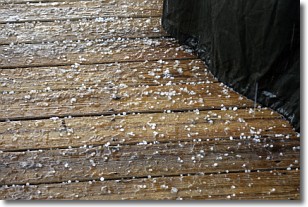
Weather Topic: What is Sleet?
Home - Education - Precipitation - Sleet
 Next Topic: Snow
Sleet is a form of precipitation in which small ice pellets are the primary
components. These ice pellets are smaller and more translucent than hailstones,
and harder than graupel. Sleet is caused by specific atmospheric conditions and
therefore typically doesn't last for extended periods of time.
The condition which leads to sleet formation requires a warmer body of air to be
wedged in between two sub-freezing bodies of air. When snow falls through a warmer
layer of air it melts, and as it falls through the next sub-freezing body of air
it freezes again, forming ice pellets known as sleet. In some cases, water
droplets don't have time to freeze before reaching the surface and the result is
freezing rain.
Next Topic: Snow
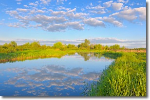
Weather Topic: What are Stratocumulus Clouds?
Home - Education - Cloud Types - Stratocumulus Clouds
 Next Topic: Stratus Clouds
Stratocumulus clouds are similar to altocumulus clouds in their
fluffy appearance, but have a slightly darker shade due to their additional mass.
A good way to distinguish the two cloud types is to hold your hand out and measure
the size of an individual cloud; if it is the size of your thumb it is generally
an altocumulus cloud, if it is the size of your hand it is generally a
stratocumulus cloud.
It is uncommon for stratocumulus clouds to produce precipitation, but if they do
it is usually a light rain or snow.
Next Topic: Stratus Clouds
Current conditions powered by WeatherAPI.com


