Weather Alert in Washington
Winter Weather Advisory issued February 16 at 8:50AM PST until February 17 at 12:00PM PST by NWS Seattle WA
AREAS AFFECTED: Willapa and Black Hills; Southern Hood Canal; Lake Crescent Area Including US 101; Foothills of the Western and Southern Olympic Peninsula; Lower Chehalis River Valley
DESCRIPTION: * WHAT...Snow showers expected. Total snow accumulations of 1 to 3 inches. * WHERE...Foothills of the Western and Southern Olympic Peninsula, Lake Crescent Area Including US 101, Lower Chehalis River Valley, Southern Hood Canal, and Willapa and Black Hills. * WHEN...Until noon PST Tuesday. The snow potential will gradually shift southward from the northern Olympic Peninsula today south toward Grays Harbor and the Hood Canal tonight. * IMPACTS...Roads, and especially bridges and overpasses, may become slick and hazardous. Plan on wintry road conditions. The hazardous conditions could impact the Monday evening and Tuesday morning commutes. * ADDITIONAL DETAILS...As of 845 am, snow was being observed along U.S. Highway 101 west of Lake Crescent. Precipitation will come in the form of hit and miss showers while temperatures generally hover in the low to mid 30s. However, quick accumulations will be possible in heavy showers creating rapidly deteriorating road conditions.
INSTRUCTION: Slow down and use caution while traveling. Prepare for possible power outages. Be prepared for wintry road conditions. Slow down and use caution while driving. If you are going outside, watch your first few steps taken on stairs, sidewalks, and driveways. These surfaces could be icy and slippery, increasing your risk of a fall and injury.
Want more detail? Get the Complete 7 Day and Night Detailed Forecast!
Current U.S. National Radar--Current
The Current National Weather Radar is shown below with a UTC Time (subtract 5 hours from UTC to get Eastern Time).

National Weather Forecast--Current
The Current National Weather Forecast and National Weather Map are shown below.

National Weather Forecast for Tomorrow
Tomorrow National Weather Forecast and Tomorrow National Weather Map are show below.

North America Water Vapor (Moisture)
This map shows recent moisture content over North America. Bright and colored areas show high moisture (ie, clouds); brown indicates very little moisture present; black indicates no moisture.

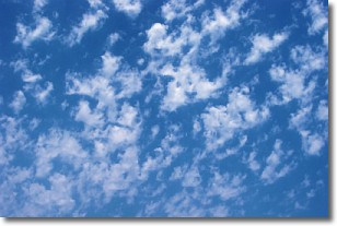
Weather Topic: What are Fractus Clouds?
Home - Education - Cloud Types - Fractus Clouds
 Next Topic: Freezing Rain
A fractus cloud (scud) is a fragmented, tattered cloud which has
likely been sheared off of another cloud. They are accessory clouds, meaning they
develop from parent clouds, and are named in a way which describes the original
cloud which contained them.
Fractus clouds which have originated from cumulus clouds are referred to as
cumulus fractus, while fractus clouds which have originated from stratus clouds
are referred to as stratus fractus. Under certain conditions a fractus cloud might
merge with another cloud, or develop into a cumulus cloud, but usually a
fractus cloud seen by itself will dissipate rapidly.
They are often observed on the leading and trailing edges of storm clouds,
and are a display of wind activity.
Next Topic: Freezing Rain
Weather Topic: What is Graupel?
Home - Education - Precipitation - Graupel
 Next Topic: Hail
Graupel is a form of precipitation that is created by atmospheric conditions
which cause supercooled water droplets to contact snow crystals and freeze to
their surface.
Sometimes known as soft hail or snow pellets, graupel is delicate and easily
destroyed by touch. Whereas hail usually falls during severe weather, graupel
doesn't require such conditions to form, and can form in mild precipitation
similar to situations which produce snowfall.
Next Topic: Hail
Current conditions powered by WeatherAPI.com


